
1-China floods (1931) Death Toll: 1.000.000–4.000.000
 The 1931 Central China floods or the Central China floods of 1931 are a series of floods that occurred during the Nanjing decade in the Republic of China era. It is generally considered the deadliest natural disaster ever recorded, and almost certainly the deadliest of the 20th century (when pandemics are discounted) and in China. The human casualties are estimated from 3.7 million to 4 million.
2-Yellow River flood (1887) Death Toll: 900.000–2.000.000


The Yellow River (Huang He) in China is prone to flooding, due to the broad expanse of largely flat land around it. The 1887 Yellow River floods devastated the area, killing between 900,000-2,000,000 people. It was one of the deadliest natural disasters ever recorded. For centuries, the farmers living near the Yellow River had built dikes to contain the rising waters, caused by silt accumulation on the riverbed. In 1887, this rising riverbed, coupled with days of heavy rain, overcame the dikes, causing a massive flood. The waters of the Yellow River are generally thought to have broken through the dikes in Huayankou, near the city of Zhengzhou in Henan province. Owing to the low-lying plains near the area, the flood spread very quickly throughout Northern China, covering an estimate 50,000 square miles, swamping agricultural settlements and commercial centers. After the flood, two million were left homeless. The resulting pandemic and lack of basic essentials claimed as many lives as those lost directly by the flood itself. It was one of the worst floods in history, though the later 1931 Yellow River flood may have killed as many as four million.

 Take Xintan earthquake as an example, let's take a look at the elevation change of benchmark. There, the elevation increased sharply at a speed of 82-110mm per year from December of 1964, contrary to its usual trend of falling down. On March 15, 1996, the figure turned to another abrupt fall and the earthquake took place on March 22.


2-Yellow River flood (1887) Death Toll: 900.000–2.000.000


The Yellow River (Huang He) in China is prone to flooding, due to the broad expanse of largely flat land around it. The 1887 Yellow River floods devastated the area, killing between 900,000-2,000,000 people. It was one of the deadliest natural disasters ever recorded. For centuries, the farmers living near the Yellow River had built dikes to contain the rising waters, caused by silt accumulation on the riverbed. In 1887, this rising riverbed, coupled with days of heavy rain, overcame the dikes, causing a massive flood. The waters of the Yellow River are generally thought to have broken through the dikes in Huayankou, near the city of Zhengzhou in Henan province. Owing to the low-lying plains near the area, the flood spread very quickly throughout Northern China, covering an estimate 50,000 square miles, swamping agricultural settlements and commercial centers. After the flood, two million were left homeless. The resulting pandemic and lack of basic essentials claimed as many lives as those lost directly by the flood itself. It was one of the worst floods in history, though the later 1931 Yellow River flood may have killed as many as four million.
References
- ^ a b c Encyclopedia of Disasters: Environmental Catastrophes and Human Tragedies, Angus M. Gunn, 2007, chapter 35: 'Yellow River China flood 1887', pp 141-144 (this source quotes the figure of 900,000, and 2 million homeless, though some sources give other figures)
- ^ Understanding Global Security, Peter Hough, 2008, chapter 8, page 192, table 8.1 'The ten worst natural disasters in history'
- ^ Trimble, Stanley Wayne (2007). Encyclopedia of Water Science. CRC Press. pp. 383. ISBN 0-8493-9627-1.
3- Shaanxi earthquake (1556) Death Toll: 830.000

The 1556 Shaanxi earthquake or Jiajing earthquake is the deadliest earthquake on record, killing approximately 830,000 people. It occurred on the morning of 23 January 1556 in Shaanxi, during the Ming Dynasty. More than 97 counties in the provinces of Shaanxi, Shanxi, Henan, Gansu, Hebei, Shandong, Hubei, Hunan, Jiangsu and Anhui were affected. An 840-kilometre (520 mi)-wide area was destroyed, and in some counties 60% of the population was killed. Most of the population in the area at the time lived in yaodongs, artificial caves in loess cliffs, many of which collapsed during the catastrophe with great loss of life.
An earthquake happened in the intersecting parts of Shan'xi and Shanxi. The earth sound was like the rumbling of thunders. The plateau and the plain all had cracks. The directions of the roads were even changed. Trees fell upside down and the mountains were rocked in the bottom part.
 |
The hills and valleys had a lot of changes. Those rising became hills and those lowered down, became deep valleys. Within an area of 1000 kilometers, not many people survived. Fires were on for several days and the people lived in the open air. Many robberies and lootings happened. Numerous people died of the earthquake, the fire, the flood and robberies.
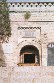
The Poem Tablet for Reconstruction of Pu Jiu Temple
"At the time of Jiajing of Ming Dynasty, an earthquake happened in Puzhou. The tower of Pujiu Temple was also destroyed. The Prefect in charge of Tongliang ordered the chief monk to reconstruct the temple.
The Poem Tablet for Reconstruction of Pu Jiu Temple
"At the time of Jiajing of Ming Dynasty, an earthquake happened in Puzhou. The tower of Pujiu Temple was also destroyed. The Prefect in charge of Tongliang ordered the chief monk to reconstruct the temple.
 |
The Buddism Cave in Pujiu Temple
|
"A serious earthquake happened in 1556 of Ming Dynasty... the sacred place became relics. Now Buddha show His miracle again and the temple was reconstructed. Aftershocks occurred 3 to 5 times each month for half a year and the shocks did not finish for three years. But it became ligher, and stopped to occur 5 years after"
More than 97 counties and states in Shanxi, Henan, Gansu, Hebei, Shandong, Hubei, Hunan, Jiangsu and Anhui suffered the earthquake.
More than 97 counties and states in Shanxi, Henan, Gansu, Hebei, Shandong, Hubei, Hunan, Jiangsu and Anhui suffered the earthquake.
References
On July 28, 1976, an earthquake of 7.8 magnitude occurred in Tangshan City. The epicenter was the City center itself. This was a rare city earthquake. Just in a second, a city with one million people was razed to the ground. The people and the city suffered much from the earthquake. Even Beijing and Tianjin were severely affected. The damage coverage was above 30,000 kilometers. The shock could be felt in 14 provinces, cities and municipalities, one-third of the country territory. The earthquake took place at mid-night. Most of people couldn't take any action and were buried in the ruins and relics. The mizoseismal regions covered an area of 47 square km at the two sides of Jing-Shan railway, in which all buildings were completely ruined. One 8-km-long and 30-meter-wide slip cut through courtyards, houses, roads and canals. In the earthquake area and nearby, there appeared many crack zones, watersprouts and sand boils, hole blow, gravity landfalls, rolling stones, side slope, foundation subsidence, Karst cave downdrop and collapses of the hollow areas etc., causing 242,000 people to die and 164,000 heavily injured. Just in Tangshan, 1700 people suffered the disability in his rest of life. The direct economic loss was 540 million yuan as well as the damages of 530 houses and 1479 square kilometers of public houses. Water, power, communication and traffic were completely destroyed. All the mines stopped, and the infrastructure including hospitals and pharmaceutical equipment were completely destroyed.
During the earthquake, seven commodity and oil container trains were derailed. The highway bridge over the Jiyun River and Luan River collapsed and cut off the traffic from Tangshan to Tianjin and the Northeast. Water pipelines and water plants were severely damaged. Buildings and infrastructures in Kailuan Mines were damaged too. The underground work was stopped and nearly ten thousand workers were blocked there. Tangshan Iron and Steel Corporation were forced to stop. The melting iron and steel was solidified in the furnace. Three large-size reservoirs and two medium-size dams collapsed and were split. The wave-proof walls were crashed down. 240 of the 410 small reservoirs were destroyed, 60,000 pumped wells were stuffed with sand. The sand-covered plowland was as much as 33,000 hectares, salt water-flooded soil was 47,000 hectares. Farm machines and instrument that were damaged were 55,000 pieces. 36,000 livestock and 442,000 pigs were killed. The living environment deteriorates quickly and intestine infectious diseases spread wide. After the earthquake, the central government organized and arranged emergent rescues. As a result, 300,000 out of 600,000 people escaped from danger. The PLA (Chinese People's Liberation Army) sent nearly 150,000 soldiers for the rescue work. The taking-off and landing of the aircrafts reached up to 390 planes each day. 159 special health care trains were sent into the place. The government in all level also settled problems such as drinking, eating and clothing of the mass in a timely manner. The preparatory work for the reconstruction started from the end of 1976. During the ten years after 1978, a new Tangshan had been rebuilt and well developed.
Ground Deformation
As can be seen from the results of recent geodetic measurement, the strong earthquakes were all companied by changes in topologies. So to speak, the Bohai earthquake in 1969, the Yangjiang earthquake in Guangdong Province, Tonghai earthquake in 1970, and Yuxin earthqake in Yunnan were all accompanied by ground deformation.
Take Xintan earthquake as an example, let's take a look at the elevation change of benchmark. There, the elevation increased sharply at a speed of 82-110mm per year from December of 1964, contrary to its usual trend of falling down. On March 15, 1996, the figure turned to another abrupt fall and the earthquake took place on March 22.
In 1968, before the earthquake of 8.5 magnitudes occurred in Tancheng of Shandong, there was a small island to the East of the epicenter area. Because the ground surface swelled slightly, that small island kept rising slowly. Afterwards, the small island even connected with the continent. When the earthquake took place, the ground to the East of the epicenter area rose up abruptly and held back the sea water 15 km to the East of Ganyu, Jiangsu province.
The US seismologist set up more than 80 observation stations along the St. Andrews Grant Fault. The activities of the Grant Fault cause earthquakes to occur most frequently along the Western Californian coast. The outstanding feature of that topology was of its horizontal deviation. The two sides of the Grant Fault deviated 6.4 meters away when an earthquake took place in 1906. Calculated by geological method, the displacement was as long as 500 km from Jurassic Period to the present. Judged by the satellite data, the horizontal shear relative speed somewhere in Grant Fault is 5 cm per year.
In Japan, before several severe earthquakes, unusual phenomena also occurred. 9 hours before Sinxie earthquake in 1964 in Japan, unusual things appeared.
As is known, the fault movements in the underground are the direct reasons for most of the earthquakes. The deformation measurement can monitor the fault activities. Together with other methods, such as to monitor the earthquake sounds to detect the micro split in faults, it is possible for mankind to judge the accurate state of the fault activity. If we go on with this chain of thought, we could conclude that deformation measurement could provide quite important evidence for the forecast of earthquakes.
References
4-Bhola cyclone (1970) Death Toll: 500.000

References
The 1970 Bhola cyclone was a devastating tropical cyclone that struck East Pakistan (nowBangladesh) and India's West Bengal on November 12, 1970. It was the deadliest tropical cyclone ever recorded, and one of the deadliest natural disasters in modern times.[2] Up to 500,000 people lost their lives in the storm, primarily as a result of the storm surge that flooded much of the low-lying islands of the Ganges Delta. This cyclone was the sixth cyclonic storm of the 1970 North Indian Ocean cyclone season, and also the season's strongest, reaching a strength equivalent to a Category 5 hurricane.
The cyclone formed over the central Bay of Bengal on November 8 and travelled north, intensifying as it did so. It reached its peak with winds of 185 km/h (115 mph) on November 12, and made landfall on the coast of East Pakistan that night. The storm surge devastated many of the offshore islands, wiping out villages and destroying crops throughout the region. In the most severely affected upazila, Tazumuddin, over 45% of the population of 167,000 was killed by the storm.
The Pakistani government led by Junta leader General Yahya Khan was severely criticized for its delayed handling of the relief operations following the storm, both by local political leaders inEast Pakistan and in the international media. The opposition Awami League gained a landslide victory in the province, and continuing unrest between East Pakistan and the central government triggered the Bangladesh Liberation War, which concluded with the creation of the country of Bangladesh. This storm would also inspire ex-Beatle George Harrison to organize The Concert for Bangladesh, the prototype benefit concert, to raise money for aid, in 1971.
The 1970 Bhola cyclone was a devastating tropical cyclone that struck East Pakistan (now Bangladesh) and India's West Bengal on November 12, 1970. It was the deadliest tropical cyclone ever recorded, and one of the deadliest natural disasters in modern times.Up to 500,000 people lost their lives in the storm, primarily as a result of the storm surge that flooded much of the low-lying islands of the Ganges Delta, many of which had been settled illegally. This cyclone was the sixth cyclonic storm of the 1970 North Indian Ocean cyclone season, and also the season's strongest, reaching a strength equivalent to a Category 3 hurricane.
5-India Cyclone (1839) Death Toll: 300.000

A 40-foot storm surge from a huge cyclone that hit Coringa, India on November 25 killed 300,000 people
From Wikipedia, the free encyclopedia
The years before 1980 featured the pre-1980 North Indian Ocean cyclone seasons. Each season was an ongoing event in the annual cycle of tropical cyclone formation. The North Indian tropical cyclone season has no bounds, but they tend to form between April and December, with peaks in May and November. These dates conventionally delimit the period of each year when most tropical cyclones form in the northern Indian Ocean.
Below are the most significant cyclones in the time period. Because much of the North Indian coastline is near sea level and prone to flooding, these cyclones can easily kill many with storm surge and flooding. These cyclones are among the deadliest on earth in terms of numbers killed.
-6-Antioch earthquake (526) Death Toll: 250.000

In 526 during late May, probably between the 20th and the 29th, a major earthquake hit Syria and Antioch, Turkey, killing approximately 250,000 people. The earthquake was followed by a fire that destroyed most of the buildings left standing by the earthquake. Damage estimates on the Modified Mercalli scale are; VIII Antioch, VII Dafna & Seleucia Pieria. In the port of Seleucia Pereia an uplift of 0.7 - 0.8 m has been estimated, and the subsequent silting up of the harbour left it unusable. This event was the sixth deadliest natural disaster in history and the third deadliest earthquake.
7-Tangshan earthquake (1976) Death Toll: 242.000

The Tangshan Earthquake also known as the Great Tangshan Earthquake, was a natural disaster that occurred on July 28, 1976. It is believed to be the largest earthquake of the 20th century by death toll. The epicenter of the earthquake was near Tangshan in Hebei, People's Republic of China, an industrial city with approximately one million inhabitants. The number of deaths initially reported by the Chinese government was 655,000, but this number has since been stated to be around 240,000 to 255,000. A further 164,000 people were recorded as being severely injured. The earthquake came in between a series of political events involving the Communist Party of China. It shook China both literally and figuratively in 1976, which was later labeled a "Year of curse".
The earthquake hit in the early morning, at 03:42:53.8 local time (1976 July 27 19:42:53.8 UTC), and lasted for around 10 seconds. Chinese Government's official sources state 7.8 on the Richter magnitude scale, though some sources listed it as high as 8.2. It was followed by a major 7.8 magnitude aftershock some 16 hours later, increasing the death toll.
8-Haiyuan earthquake (1920) Death Toll: 240.000

1920 Haiyuan earthquake, was an earthquake that occurred on December 16, 1920. The epicenter was 36°30′N 105°42′E / 36.50°N 105.70°E / 36.50; 105.70, in Haiyuan County, Ningxia Province, Republic of China. It was also called the 1920 Gansu earthquake because Ningxia was a part of Gansu Province when the earthquake occurred.
The earthquake hit at local time 20:06:53 (GMT 12:06:53), reportedly 7.8 on the Richter magnitude scale, followed by a series of aftershocks for three years. Today's Chinese media claim the earthquake as of magnitude 8.5, although the scale is not specified. It caused total destruction (XII - the maximum intensity on the Mercalli scale) in the Lijunbu-Haiyuan-Ganyanchi area.
9-Indian Ocean earthquake/tsunami (2004) Death Toll: 230.000

The 2004 Indian Ocean earthquake was an undersea megathrust earthquake that occurred at 00:58:53 UTC on December 26, 2004, with an epicentre off the west coast of Sumatra, Indonesia. The quake itself is known by the scientific community as the Sumatra-Andaman earthquake. The resulting tsunami itself is given various names, including the 2004 Indian Ocean tsunami, Asian Tsunami, Indonesian Tsunami, and Boxing Day Tsunami.
The earthquake was caused by subduction and triggered a series of devastating tsunamis along the coasts of most landmasses bordering the Indian Ocean, killing nearly 230,000 people in fourteen countries, and inundating coastal communities with waves up to 30 metersfeet) high. It was one of the deadliest natural disasters in recorded history. Indonesia, Sri Lanka, India, and Thailand were the hardest hit. (100
With a magnitude of between 9.1 and 9.3, it is the second largest earthquake ever recorded on aseismograph. This earthquake had the longest duration of faulting ever observed, between 8.3 and 10 minutes. It caused the entire planet to vibrate as much as 1 cm (0.4 inches) and triggered other earthquakes as far away as Alaska.
The plight of the many affected people and countries prompted a widespread humanitarian response. In all, the worldwide community donated more than $7 billion (2004 U.S. dollars) in humanitarian aid.
\
10- Banqiao Dam flood (1975) Death Toll: 90,000–230,000

The Banqiao Reservoir Dam and Shimantan Reservoir Dam are among 62 dams in Zhumadian Prefecture of China's Henan Province that failed catastrophically or were intentionally destroyed in 1975 during Typhoon Nina. The dam failure caused the sudden loss of 18 GW of power, the equivilant of roughly 9 large modern coal fired power stations, or about 1/3 the peak demand on the UK National Grid.
No comments:
Post a Comment